Feeds:
Posts
Comments

Archive for the ‘Thule’ Category

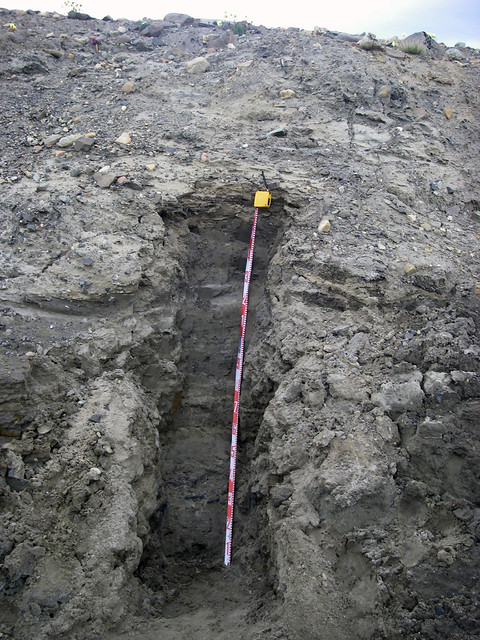
The fieldwork is done and now the time comes for the next phase of the process… proposal writing! This summer, I spent the month of July in Thule, northwestern Greenland (you can access my older posts here). I sampled large, glacially-transported boulders for cosmogenic dating as well as marine shells for radiocarbon dating. Now, my task is to obtain the funds to support the analytical costs of processing and measuring the samples.

54. View from BMEWS

View towards Wolstenholme Fjord and North Ice Cap in Thule. A spectacular area!

The goal of this work is to unravel the landscape history of the Thule area. In particular, I am interested in how this complex landscape has evolved over both space and time. After spending three field seasons in Thule, I’ve had ample opportunity to observe the landscape and have identified two different units of glacial sediment that are in separate, but adjacent, areas. For each of these sedimentary units, I will explore the following questions:

1.) How old are the sediments? Were they deposited during the most recent glacial period, or are they a product of an older glaciation?

2.) What is the surface history of the sediments? How long have they been exposed, and do they record times of burial by non-erosive glacial ice?

3.) How erosive was the glacial ice that covered the landscape? Was it an effective agent of change, or was it non-erosive and capable of preserving a relict surface?

4.) What body of glacial ice deposited the sediments? Were they deposited by the Greenland Ice Sheet or by a small outlet glacier during a subsequent re-advance?

33. Favorite moraine

A gorgeous (and very large) glacial moraine near Thule. How old was the ice advance that deposited this moraine?? Hopefully I’ll be able to answer that question later this year!

Through my exploration of these questions, I will address not only the history of the Thule area, but also fundamental questions about the landscape evolution processes at play. Because the area around Thule is complex both spatially and temporally, it provides an ideal opportunity to study a wide range of processes that drive landscape evolution at high latitudes.

The process of writing this proposal has been a very valuable learning experience for me. It has encouraged me to think about the larger significance of my work; in essence, taking my work from a “postage stamp” project (i.e. one that addresses a small, specific area) to a larger and more relevant project addressing ideas that are widely transferable to other areas.

I look forwards to learning more about high-latitude landscape evolution over the coming year!

28. Secret Place

Panoramic view across the Thule landscape, looking towards Wolstenholme Fjord (photo courtesy of my fabulous field assistant Everett Lasher).

Read Full Post »

After a very successful three weeks of work in northwestern Greenland, it was time for Everett and I to say goodbye to Thule. We shipped home boxes of rocks (which elicited several questions from the Air Force Post Office personnel), parted ways with our trusty Toyota Hilux (after a much-needed trip to the truck wash), said goodbye to the many friends we made during our stay on base, and boarded a New York Air National Guard LC-130 for our trip home.

61. Cold-based ice

A fun hike up Mt. Dundas on our last day in Thule. The sea ice finally broke up on July 15.

On our way up to Thule, we flew directly from the US with the Air Mobility Command. On the way home, however, we flew with the National Guard through Kangerlussuaq, where we had a two-night layover. Two very wonderful things happened during this trip home: first, I got to ride on the flight deck for my birthday; second, we met up with this year’s IGERT group in Kangerlussuaq.

The flight from Thule to Kangerlussuaq was spectacular. I immediately announced to the Air National Guard crew that it was my birthday (which it was), and was thrilled when I got an invitation to ride on the flight deck for the last ~45 minutes of the trip. We requested permission to fly line-of-sight, then dropped low into the fjord for an absolutely amazing ride. The views were incredible, and we even passed right above the heads of a big herd of musk ox. I have an excellent track record of scoring special flight privileges on my birthday in Greenland, and this was no exception. The six passengers in the cargo bay may have become slightly air sick, but it was a small price to pay for such a ride (easy for me to say!).

62. Birthday flight to Kanger

Flight deck of the LC-130 on the way from Thule to Kangerlussuaq. Best seat in the plane!

We were only in Kangerlussuaq for a day and a half, but it was wonderful to be reunited with friends from IGERT Cohort 4. Developing this extended family of scientists has been a huge benefit of participating in the IGERT program, and I can’t describe how happy I was to have my layover in Kangerlussuaq coincide with the 2013 field seminar. We celebrated my birthday in style with burritos and ice cream after we arrived, then filled the next day with a long hike and a celebratory dinner (since the IGERTs just completed a very productive stay at Summit!) at the only restaurant in town.

69. IGERT hike in Kanger

IGERTs hike down towards Lake Ferguson after a full day on the trail in Kangerlussuaq.

Thank you to Mary, Ross, Matt, and all of Cohort 4 for letting us finish our trip on such a high note and in such good company! Best of luck on the rest of your trip in Kangerlussuaq, Nuuk, and Ilulissat.

Read Full Post »

In an earlier post (Reading the Landscape), I described how we study landscape features in northwestern Greenland to try to reconstruct past events. For example, we can use glacial moraines to make inferences about the extent of past re-advances of the ice sheet or its outlet glaciers. This type of work focuses on the larger perspective: the landscape as a whole.

This past week, we’ve shifted out focus to investigating specific areas in much more detail. In particular, we dig pits in the ground and study the sediments we find; we call this studying the stratigraphy. Reading a record of past sediments is similar to reading an ice core: sediments get laid down progressively over time, with the oldest sediments being on the bottom and the youngest sediments being on the top. We can use the sequence of sediments to make inferences about how the area has evolved over the recent geological past, since the end of the Last Glacial Period.
Section7_C

A big excavation project: we dug this 1.5-meter tall section into a stream bank near the fjord in Thule.

Some of the areas we excavated have yielded an interesting story. The sediment on the bottom appears to be mostly silt and contains an abundance of marine shells. On top of that is a thick sequence of nicely layered sands; these layers are sometimes folded or truncated. The top unit in the sequence is an unlayered sandy material with abundant large rocks that appears to be glacial till.
Section7_K

We found shells! This one was embedded in the silty/sandy material ~30 cm from the bottom in the section shown above.

My mission, after returning home from Thule, is to analyze the data from this work and try to unravel the sequence of events. For example, one possible scenario is that relative sea level was higher after the end of the Last Glacial period, depositing the shell-rich and sandy layers in an area that is now 20-30 m above present-day sea level. Later, the glaciers in the fjord re-advanced over the marine sediments and covered the landscape in glacial till. In addition to interpreting the sequence of sediments, we can also use radiocarbon dating to determine the age of the shells and cosmogenic dating to determine the age of the boulders in the glacial till. Using these techniques will allow us to understand how the landscape in northwestern Greenland has evolved during the present interglacial period.

Read Full Post »

Older Posts »